
About Adventure Mapper

An adventure's story belongs on a map

A map-first travel journal. First the route, the days and the small discoveries in between. And then publish a page anyone can wander through, past the parts you wrote down.

Places
Everywhere you stopped
Days
What happened there
Spots
The small finds between

The story of its creation

I rode to Pittsburgh and had nowhere to put it
Dozens of hot air balloons rising into a clear blue sky — a stand-in image, not from the ride
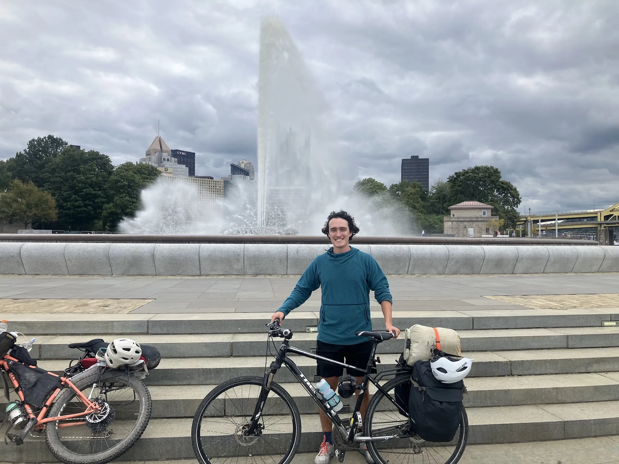
Me at the end of the trail at Point State Park in downtown Pittsburgh, PA

Back in the fall of 2024, I saw a YouTube video of someone bikepacking the C&O Canal Towpath from Washington, D.C. to Cumberland, Maryland. This was practically in my backyard, and somehow I'd never heard of it. I pulled up Google Maps to investigate and discovered that, by continuing along the Great Allegheny Passage, I could ride all the way from D.C. to Pittsburgh. So I threw caution to the wind, bought some panniers for my trusty steed, and rode off the next month (after securing some time off work).

While traveling, I wanted to share where I was with family and friends, but I wanted them to experience some of the same thrill of discovery I'd felt when I first found the trail. I wanted them to explore the trip through a map: where I took each picture, the route I cycled each day, the extra day I spent wandering around Pittsburgh, and where I was setting up camp that night (or, in my case, the motel I had retreated to... thanks, rain). I wanted someone to be able to look at the map, see where I was, and say, "You're right near this place. You have to check it out." Even if they weren't there, they could still be part of the adventure.

The travel-sharing apps I found were either too social media-y or too rigid to tell the story the way I wanted. I didn't want to make another post about my day, and I didn't want my trip reduced to a linear list of stops.

The trip happened on a map.

Every day had a place. Every place had something worth saying about it. A feed flattened all of that into a scroll that was gone by the next morning. I wanted something that I could look back on in 10 years and be able to remember all the tiny details of my trip.

I wanted to show the adventure as I actually lived it.

That's when I started thinking about building something for myself. And, as luck would have it, adventuremapper.com was available. So I had my name.
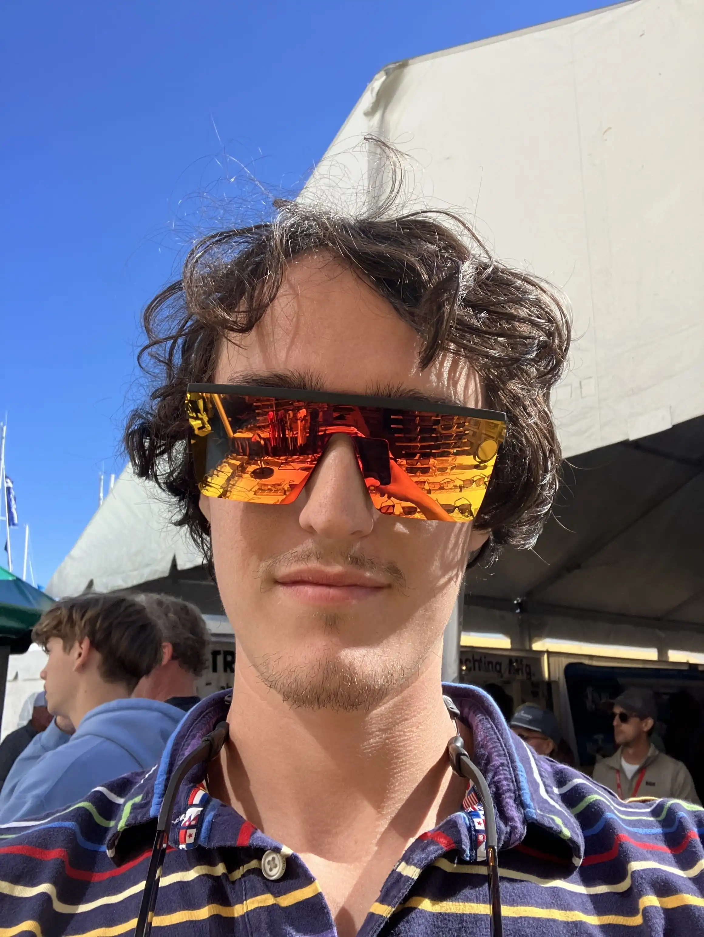
Jared

Adventurer

335
Miles ridden
5
Days on the trail
1
App that fit
0
Before this one

What it is

A travel journal where the map is the page

A trip is built from three things: the places you stopped, the days you spent there, and the spots you found in between. Stack them and you get one interactive page on the open web.

Most travel apps hand you a timeline. You post, the post scrolls away, and a year later the trip is a stack of images with no shape. Adventure Mapper starts from the geography instead. Every part of an adventure is attached to a real place, so the story has a structure that matches the way you actually moved through it.

It works for a three-week bike tour, a weekend of camping, a single day in a new city, or a list of the best beaches on an island. The structure bends to the trip rather than the other way around.

Every adventure has three layers: a landscape with a route and pins running across it, a week of days beneath it, and a row of small finds beneath that — labelled Places, Days and Spots
  • Places — everywhere you stopped
  • Days — what happened there
  • Spots — the small finds between

The three layers, in full

Places
Everywhere you stopped. Drop a pin and the route draws itself between them whether you took a train, walked, or just went for a long drive.
Days
What happened while you were there. Stay a week and each day gets its own page. Passing through? Skip days entirely.
Spots
The small things worth pinning: the viewpoint, the bakery, the swimming hole nobody signposted.

Mission & vision

Everyone knows how to read a map.

Maps are a language everyone already speaks. Point to a corner of the world you’ve never been to and it suddenly feels a little closer. You start to wonder what it would be like to stand there. Adventure Mapper grew out of that feeling.

Mission

Help people record their adventures in a way that inspires more of them.

Exploring the world, its people, and its places is the most important thing to me. A journal that just sits there does half the job. The other half is making you, or someone else, want to go.

Vision

A world map covered in first-hand adventures, route by route.

Every great route, from the Appalachian Trail to the Camino to the C&O Canal towpath, carrying the stories of the people who actually traveled it — so the next person plans their trip by being inspired by real ones.

Who it's for

One person went. Everyone else gets to look around.

Most travel tools are built for the person who went. Adventure Mapper is built for both sides of the trip, because the reader is the one who might go next.

If you went

A record that holds its shape

Everywhere you stopped, every day you stayed, every small find in between — in the order you lived it, on the map where it happened. Not a post that scrolls away. A page you can send to your family and open again in ten years.

If you're reading

Permission to wander off the route

The route is where the story went, not where the map ends. Follow it, then drift: the cove one headland over, the trail the writer never took, the town in the next valley. You'll find things the writer missed. Going to see them for yourself is the point.

An illustrated coastal route: a red line running between two pins, with dashed leaders out to places just off it — Sunset View, Hidden Waterfall, Local Market, Secluded Cove and Kayak Adventure — each labelled MISSED

What wandering looks like

“If I went on this trip, I'd have checked this out.”

That's the moment this was built for. Every trip has places the writer went past without ever mentioning them; a reader zooms out, spots one a half mile off the route, and starts planning a trip of their own. A photo feed can't give you that moment. An open map gives it to you all the time.

  • Zoom past the last pin
  • See what was nearby
  • Go take the trip

Questions

Frequently asked

What is Adventure Mapper?

Adventure Mapper is a map-first travel journal. You build a trip out of the places you stopped, the days you spent there, and the spots you found in between, and it publishes as an interactive map on its own public web page. Anyone with the link can follow the route, read the story, and explore the map beyond it.

Who makes Adventure Mapper?

Adventure Mapper is built by me, Jared Hood, a software engineer and adventurer who wanted a better way to share his adventures. It's a one-person project for now, which means the same person writing the code is also answering the emails, obsessing over maps, and occasionally breaking things. Just like my dad taught me, we only test in production here.

Is Adventure Mapper free?

It's invite-only while we get it right, and free for everyone on the list. Once we go live there will be a generous free tier with a paid option as well — we have to keep the lights on somehow 🙂.

Do my friends need an account to see my trip?

No. Every published trip is a normal web page with its own link. Anyone can open it in a browser, with no app and no sign-up.

Can I map a trip I already took?

Yes. Drop in your photos and the ones with location data place themselves. Most people build a past trip faster than a live one.

Does it work for something that isn't a road trip?

Yes. A week in one city, a single day of wandering, or a guide with no dates at all, like the best beaches on an island.

Who owns my photos and writing?

You do. You can unpublish or delete a trip at any time and take your images with you.

Invite only

Get notified

Adventure Mapper is invite only while we're getting it right, so we're adding travelers a few at a time and reading what they make.

Leave your name and email and we'll send your invite the day the map opens. One email, nothing else.